Analyzing the Impact of Safety Improvement Projects on Roadway Safety
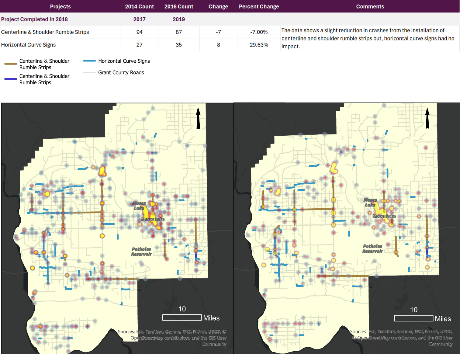
The purpose of this atlas is to demonstrate the impact of different safety improvement projects had on Grant County WA roadways. The analysis needed to analyze the number of crashes in small areas and county wide over time. To get a time phased, location based analysis, a Space Time Cube was created using 2 mile cubes and 1 year time step intervals over a 10 year time frame and then visualized using the emerging hotspot analysis. The result, while visually appealing, returned inaccurate results, which I identified by overlaying the All_Crashes layer with each crash as a point. There were notable clusters of crashes that showed no change or hot spots with the analysis. Ultimately, there were just not enough crashes to create a statistically significant analysis that is time phased. To address that issue, so I simplified the analysis by counting all the crashes within 500’ of a construction project by creating a buffer and then using the Summarize Within tool. Next, I created a table to be able to see the total number of crashes 1 year prior and 1 year after the project was completed. I did not include the year the project was completed because I did not have the before and after dates and, did not want to skew the number of pre-post crashes counted.
In summary, none of the projects demonstrated a significant change in safety. Other factors that might affect this include an increase in traffic, other construction projects not identified such as roadway widening and refreshing striping.